Exploring Central Oregon by Bicycle (Part 2 of 2)

Before I give the run-down of the rest of last weeks bike tour, here is a picture of the tent. This was taken in 2012 on my cross-country tour. The tent really is shorter than the picnic table.

IMG_0698

Day 3

Once again, it was rather cold as I began pedaling out of John Day, heading south on hwy 395. The road curved gently as it headed out of town and except for more than a dozen log trucks heading north into John Day, I had the road to myself. Growing up on the coast of Oregon with only a vague understanding of the eastern side of the state, I never really considered that there would be logging operations out here. But there seem to be plenty of trees in the Blue mountains and given the truck traffic…

IMG_5627

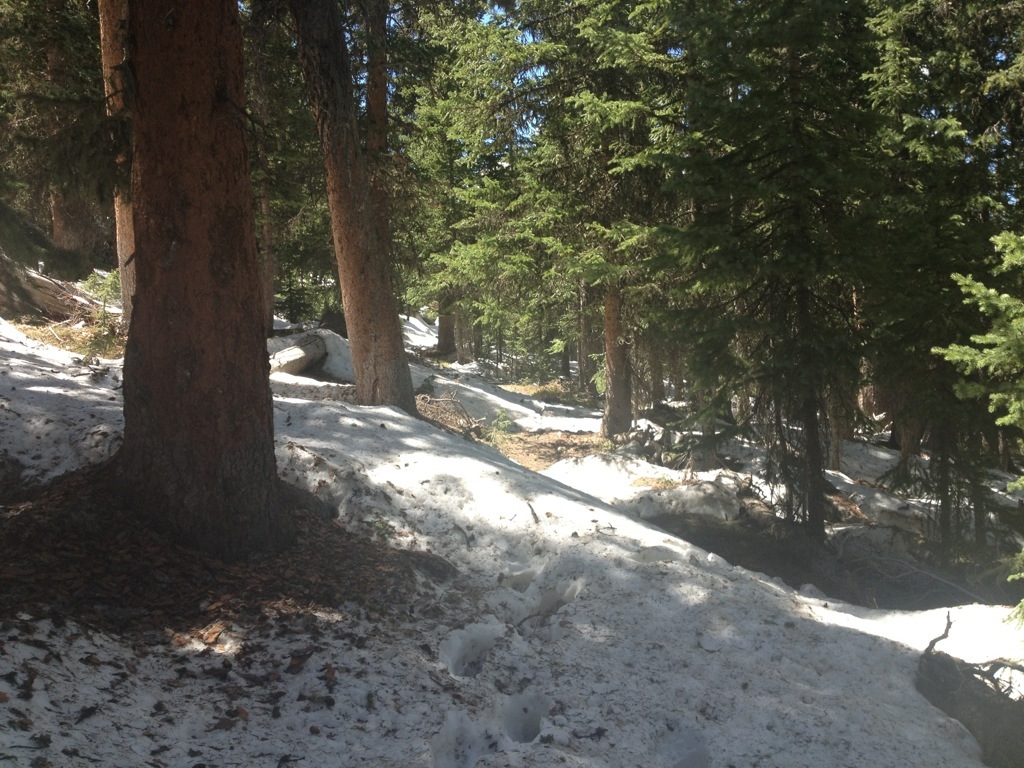
My short day yesterday seemed to have rested me as I easily cruised up the first pass of the day. On parts of the road that didn’t get any sunshine due to shadows, there was still frost and some snow clinging to the side of the road. But I soon left all that behind, well until I reached the top. Then I got to take a cool picture with my bike next to a bunch of snow with a sign of the impressive elevation I had achieved.

IMG_5638

Above: looking back down the valley I just rode up. Below: the top of the first pass.

IMG_5644

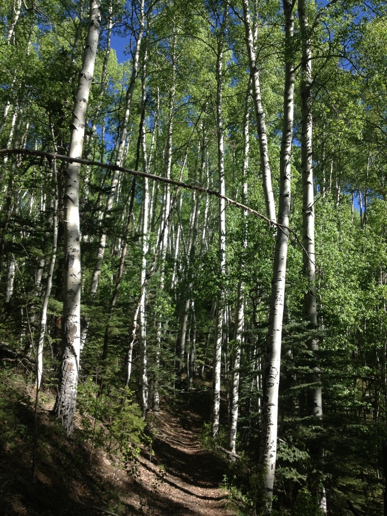
From here, the route descended a little and then leveled out into a high valley surrounded by low, snow-covered mountains. The air was cold, but the only wind was generated by my riding. Creeks were frozen. It was beautiful riding. For miles the road gently meandered through the most beautiful part of the trip, then gradually up to the final pass before heading down to Burns.

IMG_5651

IMG_5652

IMG_5670

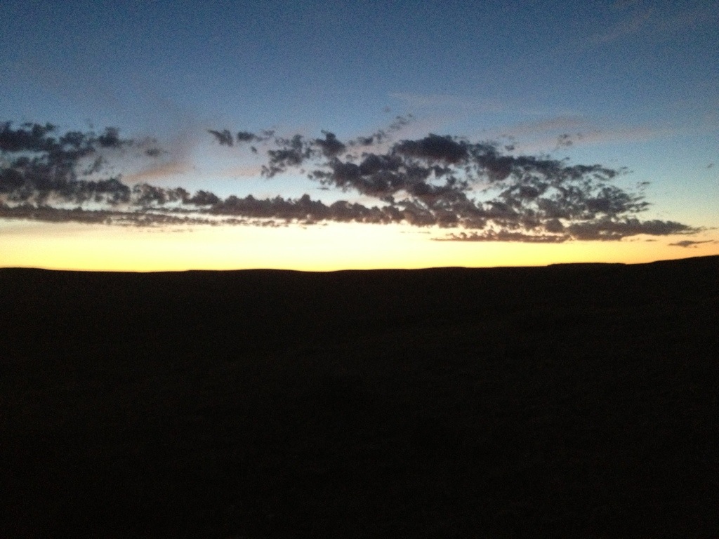
As I descended the last pass, Devine Summit, the scenery changed. The road descended into a canyon (filled with cold air) and the forest disappeared and was replaced by Oregon’s high desert. Some people don’t like deserts, but I do. I like the simplicity and the stillness. I love how, at first, deserts can appear plain, but once you start paying attention, you realize there is an endless amount to discover. In part, one thing I like most about deserts is how they keep you focused on things that are truly important: like water.

IMG_5682

Day 4

The wonderful thing about starting the morning off bicycling in a desert is that when your phone battery is low and you need a solar charge, you don’t have to wait for the sun to be high enough in the sky to reach over the trees alongside the road. Because there aren’t any trees.

Hwy 20 between Burns and Bend is, by some, considered the most boring road in Oregon. After this trip, I am not one of those people who thinks it was boring. First, the scenery is great. But, it is a desert, and just in case the scenery gets monotonous, along the road, there is a lot of history that one can absorb.

IMG_5712

IMG_5696

Unfortunately for this otherwise perfect day, the nearly non-existent tailwind I was supposed to have all day actually ended up being a mild headwind. Not nearly enough to make cycling too hard, but I definitely wasn’t traveling as fast as I would have liked. So as the day began to end and after about 85 miles, I pulled off the road and set up camp near the town of Brothers, about 45 miles from Bend. I could easily to that in the morning right?

IMG_5720

Day 5

So, I woke up, unzipped my tent door, looked out at the desert, my bicycle covered in frost, and thick fog. This was not in the forecast.

IMG_5721

The fog was so thick that I couldn’t see the road from my campsite, and I wasn’t that far from the road. I read a book for an hour thinking maybe it would burn off, but it didn’t. Well, no problem. I’m in Oregon. I packed up my bike, headed out to the road, stuck out my thumb and in 3 minutes I was loading my bike into the back of a pickup truck.

So I didn’t ride the whole 350 miles, but I still put down a little over 300 miles of cycling. It was a good adventure.

One final thing: if your looking for a good book about adventure, my reading for this trip was Ice Bound by Jerri Nielsen.

Exploring Central Oregon by Bicycle (Part 1 of 2)

So it’s finally time for this blog to became both about thru-hiking and bicycle touring. After leaving the Continental Divide Trail last summer, I made several plans for a bicycle tour but didn’t actually get past the planning. As of the start of this year, I now find myself living back in my home state of Oregon in the city of Bend. While I’ve visited the Bend area many times in the past, I have never been much farther east of here. Since the weather had been unusually warmish, with little to no wind in the forecast, last week I decided that I needed to do some exploring.

I planned a 4 or 5 day bicycle tour that would take me from Bend to the town of John Day out hwy 26. From there I would head south on hwy 395 to Burns, then head back to Bend on hwy 20. Total mileage for the trip: 350 miles.

Screen Shot 2014-01-30 at 12.16.11 PM

Day 1: Sunday, January 19

I had packed my bike the night before and the morning of the trip I woke up bright and early and was off just after sunrise (in the winter a cyclist must take advantage of all of the very short daylight hours). It was cold, but not too cold. The views of the Cascades as I looked back were fantastic.

IMG_5523

It took all morning for it to warm up, but by afternoon I was heading up hwy 26 out of Prineville with temperatures in the mid 50’s. Hwy 26 winds through the Ochoco mountains, part of northeastern Oregon’s Blue mountains. A steady up to 4,700 feet and then it was a beautiful long gently winding downhill to the tiny town of Mitchell.

IMG_5533

IMG_5538

IMG_5539

The climb had taken me most of the afternoon and I had planned to camp in the Mitchell city park, but, being down in the low point of the valley, it was already rather cold and strangely a bit smoky (Mitchell is accustom to cyclists riding through town, mostly during the summer months as they make there way across the country on the Trans-America bicycle route).

IMG_5546

(Above: After a long day of climbing, I prepare to climb again by warming up with a hot drink and add a bit of extra energy by eating a maple bar. yum!)

I decided to head up toward the next pass and camp somewhere more agreeable. As I slowly rode up again, I soon found out why it was so smoky. A controlled burn of a grassy field up the valley was going on and the smoke was drifting down. I’m glad I decided not to stay in the valley. I made it the top of the next pass (Keys Creek Summit) just as it was getting too dark to safely stay on the road. I must admit that I walked the last couple of miles up as my legs had decided that they were done pedaling for the day.

Day 2: Monday, January 20

IMG_5553

The only problem with bicycle touring in the middle of winter is the shortness of the days. Darkness had come the night before about 5:30pm and the sun didn’t come back again until nearly 7am. That meant a lot of time sitting in my tent. I had brought my very small MSR micro-zoid (the first item of “lightweight” backpacking gear that I purchased 10 years ago). The tent isn’t lightweight compared to what I use now for backpacking, and in many ways it isn’t a very good tent as it is more a glorified bivy sack with just enough room for you to lay down. The foot end of the tent is so short that my toes touch the roof if I have too much padding under them. And the roof of the tent up near my head is about 6 inches away. However, it has a small footprint which means it is very easy to find a place for it to fit amongst the brush. Also, because it is very small in height and total volume, it does well in the wind and is a very warm tent. As cozy as my little tent is, I was glad to get back on the bike.

IMG_5557

The second day’s ride was pretty easy. Since I had slept up high, I started the morning with a long (nearly 30 miles) decent, then a very gentle grade the remaining 30ish miles to John Day. As I descended, hwy 26 wound its way gently through some of the neatest scenery of the trip. Given that temperatures were in the 20’s and I was coasting downhill, I wore my big down jacket most of the morning. Next time I do a winter bike tour, I’m brining a face mask.

IMG_5566

IMG_5573

IMG_5593

I arrived in the town of John Day in mid-afternoon. From there I would turn south on hwy 395 toward Burns, but as finding camping along the road out of town would be difficult with the little daylight I had left, I decided to stay in John Day and head out the next morning. Also, my legs really wanted an easy day.

Check back for part 2 tomorrow.

The Off-Season

Today is the first day of fall, one of my four favorite seasons. It’s been a while since I posted. I must admit that since my last post on my summer excursion, I’ve been debating the continuation of this blog. For now, I’ve decided that I will continue, at least until I finish the CDT next summer. My posts will likely be less frequent until summer returns, but I’ve decided that I will post periodically until I resume the hike.

Since my return to “normal” life, I’ve been enjoying many a country road via my bicycle. While I had intended to get some overnight touring done during August, alas, I did not. And I actually don’t mind that I didn’t get around to overnight rides. There is still time before winter comes, and come to think of it, they make studded bike tires.

In addition to pedaling, I’ve returned to other parts of my normal routine; work, graduate school, the occasional canoe trip, hikes, and running, etc. On that subject (running), since I don’t have tons of scenic pictures for this post, I’ll put up a picture of my new running shoes that are awesome. They’re the from the same company (Inov8) that makes the shoes I use while thru-hiking and so far, they are the best running shoes I’ve ever worn. Olympic marathon record here I come! (Ok, maybe not, but these shoes do feel really fast).

And about the off-season:

I find it hard to look at pictures of my hiking trips this time of year, the time of year when the final bit of weariness from the last long hike has worn off, the time of year when the longing for another grand adventure returns, but when also, there is still much time before the next adventure can begin.

This is the off-season, and when I look through the pictures from my travels, I get homesick.

I’ve never been homesick for the place I grew up. Don’t get me wrong, I really like the place I grew up. My family is the best there is. The location is rather awesome as well. I visit when I can. But there is something magical about charting a course on a few thousand mile long footpath through wild and desolate landscapes. So many high mountains, so many perfect ridge-lines, rivers, forests, deserts, so many good friends made along the way, so many good campsites…

This afternoon, as I scanned through my blog, thinking about what to post, I became homesick for adventure, for a long trail, for sleeping outside night after night, for living simply, and for the wonderful peace that exists on a long, long walk.

Today is only the first day of fall, and I can already tell it’s going to be a long winter.

Good thing I have snowshoes.

Embracing the Brutality

There is a saying about hiking the Continental Divide Trail that goes like this: “embrace the brutality.” It’s a reflection on the increased level of difficulty of hiking this trail compared to the Appalachian and Pacific Crest Trails. After about 1,500 miles of hiking the CDT, I must conclude that it is deserving of the saying. Everything including water, elevation, trail construction (or lack of), navigation, and in my case, disease is more brutal on this trail. And I have truly loved the last two months.

About disease: just prior to hiking into the Copper Mtn/Frisco/Breckenridge area on about July 15, I drank some water that I didn’t treat. I’m sure many would call that stupid, and as I found out later, it seems to have been. I have had untreated water from the wilderness many times before. FYI, I’m generally very picky about what sources I drink from untreated and with nearly 10,000 miles of hiking, I’ve never been sick before. To make a long story short, it was confirmed today that I have Giardia, apparently a bit milder than it could have been as I had continued to hike for two weeks with the symptoms being manageable. But for anyone who knows about or has had Giardia, it’s not something that one can continue to live peacefully with. So I am now doing battle with Giardia and I will win thanks to some excellent prescription drugs. Embrace the brutality.

As some of you may know, last summer I road my bike 3,500 miles across North America from Washington to Maine. And if you were to ask any of the hikers I hiked with these last two months, they would tell you that I often referenced that trip and spoke about how I wanted to go bike touring again. During my time hiking in Colorado, prior to and after acquiring Giardia, I began to grow tired of hiking the CDT. And when I arrived in Rawlins, I decided that it was time to stop hiking for the summer and split the hike into two parts, the second part to be hiked next summer in 2014.

I’ve learned over the last 5 years of long distance adventuring that it isn’t worth it if all I want to do is just get to the end. Another good saying that applies well to long distance hiking is “the journey is the destination.” For me, that statement was true until I reached Rawlins, then it became clear that I was only looking forward to the destination, and that is no way to hike.

I’m sure that having Giardia played a role in wearing me out, but I also know that I’ve been wanting to go for a bike ride. So, for the remainder of the summer, I will be doing several other things including bike riding and touring once this Giardia business has cleared up. And have no fear, I will be back on the trail next summer to finish. Completing the Triple Crown is still top of my list. And by next summer I’ll be ready again to embrace the brutality of the CDT and I’ll be able to enjoy the rest of the hike to its fullest as, once again, the journey will be my destination.

– Turbo

Baby Bear Up A Tree

The hike from Steamboat Springs to Rawlins was one of the longest stretches of this trip, about 150 miles. During this stretch, the trail gradually began to change from the high elevation mountain country to dry, lower elevation great divide basin. Of course we also crossed into the great state of Wyoming, which was very exciting.

20130702-154524.jpg

20130702-154543.jpg

As you can see above, it’s a rather dramatic change of scenery. But even more exciting than the change of scenery happened just a few nights ago. Don’t Panic, Norm, and I had camped for the night. Shelters set up and all of us sleeping or just about sleeping by 9pm. Then I heard norm yelling at a bear to go away and leave our camp. Naturally, I look out my tent in time to see the bear scurry away. But it doesn’t go far. Don’t Panic observes that he bear is huffing at us from a distance, but isn’t actually leaving, which is very unusual for a bear (they usually would have been running very much away). So I hop out of my shelter to have a look and just as I’m about to get back in I notice that up the tree in the middle of our camp is a bear cub. Apparently when Norm yelled at the bears as they were stumbling past our camp, the cub decided to run up a tree, a tree that was surrounded by us camped. Needless to say we hastily packed up camp (even though we were clearly here first) and surrendered he ground to the bears. Because while normally bears really don’t want anything to do with you, a mamma bear doesn’t like it when her cub is stuck up a tree surrounded by hikers.

20130702-155541.jpg

It’s not a great picture, but the one above is of the bear cub up the tree.

Anyway, besides the bear incident, everything else went pretty normal for this stretch. The scenery changed, but still remained beautiful. And Rawlins was a nice relaxing stop.

20130702-155843.jpg

20130702-155911.jpg

20130702-155929.jpg

20130702-155937.jpg

20130702-155951.jpg

20130702-160031.jpg

20130702-160051.jpg

20130702-160104.jpg

20130702-160120.jpg

20130702-160146.jpg

Stay tuned for another update in a day or two.

– Turbo

Wyoming Bound

This will be a quick picture update for the last section between Grand Lake and Steamboat Springs, Colorado. My next stop will be Rawlings, Wyoming. Colorado has been beautiful but I am looking forward to crossing another state line. I’m still hiking with Don’t Panic. And now for pictures.

20130625-114100.jpg

20130625-114111.jpg

20130625-114136.jpg

20130625-114149.jpg

20130625-114218.jpg

20130625-114204.jpg

20130625-114230.jpg

Oh, and sorry to anyone who was looking forward to seeing how big my beard got, but I decided that I was tired of it, so I trimmed it.

20130625-114405.jpg

About Lightning and Thunder and stuff

When Don’t Panic and I arrived in Breckenridge on June 15, we went strait to Fatty’s Pizza. This is important because it is only the second pizza place I have been too on a hike that offered cashews as a pizza topping (the other pizza place is Mile High Pizza in Wrightwood California). My favorite pizza topping combination is cashews and pineapple, and it was truly fantastic to be able to enjoy this favorite.

We stayed the night with a friend of Don’t Panic and the next day, while thunderstorms rolled around on the high ridges above us, we slack-packed (hiked with only what we needed for the day in our backpacks) 13 miles of bike path from Copper Mtn through Frisco to Silverthorn, where we picked up the trail the next morning.

20130621-201007.jpg

Above: Don’t Panic poses with the bike path sign.
Below: I picked up some favorites from my homeland of Oregon at the Safeway in Frisco for my resupply.

20130621-201207.jpg

The next morning we headed out of Silverthorn and were back on trail. A thunderstorm moved in behind us. We kept an eye on it and concluded that it was not going to bother us. Much of the day we spent either postholing through snow, or keeping track of clouds and even a little waiting for a thunderstorm so we could ascend to high country. It was a beautiful day, but also a lot of work.

20130621-202702.jpg

20130621-202745.jpg

20130621-202818.jpg

20130621-202859.jpg

20130621-202930.jpg

20130621-202945.jpg

20130621-205509.jpg

The next day the thunderstorm risk was even higher and the trail remained high on the divide, above tree line, and at one point would have taken us over 13,000 feet. Also, for the first time on a long distance adventure, I was not feeling well (stomach unsettled, lasted the next day, them it was pretty much done). Because of these factors, we diverted off the divide and took a combination of roads and bike paths (some paved, mostly forest service dirt). As we looked up at the divide from below, we were glad we did this.

20130621-210023.jpg

Our final day and morning into Grand Lake were great. We were back on trail and there were no thunderstorms. Good scenery was also a plus.

20130621-210212.jpg

20130621-210227.jpg

20130621-210234.jpg

20130621-210246.jpg

We arrived in Grand Lake Thursday, have take a rest day today, and are ready to hike out tomorrow. We have encountered our first trail closure due to a fire that will prevent us from hiking through Rocky Mountain National Park, but routing past this section of trail is actually easy. Our next and last Colorado stop is the town of Steamboat Springs. It will take about three days.

I’m about 1,200 miles in and it’s still great. Canada or bust!

– Turbo

Over the Snowy Mountains

This post is the first of two posts I plan to make today. I should have updated this blog when I was in Breckenridge, but laziness overtook me. My apologies. This post covers the section of trail from Monarch Pass and Salida (where my last post was from) to Copper Mountain near Breckenridge, CO.

20130621-134506.jpg

I had hiked into Monarch Pass as a solo hiker. My hiking partner Furious had an ankle injury that needed resting. In Salida, CO, which was just down the road from Monarch Pass, I caught up with Don’t Panic. He had hiked with us for several days in earlier in New Mexico. Because he has hiked the CDT before, he was choosing an alternate route out of Monarch Pass, but our plan was to meet up in the small town of Twin Lakes.

I thought it would take three full days fore to reach Twin Lakes. But when I’m hiking solo, I get bored and sometimes lonely, so I tend to put in long days. So I reached Twin Lakes in 48 hours even though there was a few stretches of snowy terrain.

20130621-135125.jpg

20130621-135331.jpg

20130621-135414.jpg

20130621-135450.jpg

20130621-135533.jpg

The trail was actually mostly snow free. This section of trail carries in elevation as it climbed up and over the divide several times, defending into pleasant valleys after each climb. Often I would hike up a nearly snow free pass just to find the north facing slope, going down, to be covered in snow, sometimes with a complicated snow cornice like I. The last of the two above pictures. Nothing that was too difficult, and all of it beautiful.

20130621-140614.jpg

20130621-140654.jpg

20130621-140727.jpg

20130621-140748.jpg

When I arrived in Twin Lakes, it wasn’t long before Don’t Panic walked into town. We were also joined by Norm, who actually started the same day as I did and who had been ahead off until I had passed him prior to Monarch Pass. Furious also rejoined us that afternoon. We stayed all stayed the night. Norm, being a more ambitious hiker, left early for a side trip up a 14er (14,000+ foot mountain). Furious, Don’t Panic and myself left later in the morning. Unfortunately, Furious’ ankle began flaring ip again, so after a day and a half, he decided that he needed to step off trail again. Don’t Panic and I continued that day wit the goal of reaching Copper Mountain near Breckenridge. Don’t Panic had a friend we could stay with there. As for the trail there, it was more of the same. Amazing and a little snowy here and there.

20130621-141743.jpg

20130621-141928.jpg

20130621-141954.jpg

20130621-142015.jpg

In my next post, hopefully later today, I will get caught up to where I am now, which is Grand Lake, just outside Rocky Mountain National Park.

– Turbo

And Then There Were Mosquitoes

Sunday evening I arrived at Monarch Pass, and after about half an hour, I was able to hitch a ride into Salida, CO. Salida is a great town. There is a neat hostel here and it’s very close to the Safeway and a few nice restaurants. Several other hikers were here, including Don’t Panic, who hiked with us back in northern New Mexico.

So when I left Creede I was hiking solo. Furious had an ankle that was bothering him and on our way into Creede, it had begun to get worse. I talked to him yesterday and he plans to rejoin me at my next stop on Friday.

Hiking out of Creede was really neat. It’s a town that was originally built for mining operations nearby, and on the hike out of town, the route goes up through a canyon with all sorts of old mine buildings and a structures.

20130611-070944.jpg

20130611-070959.jpg

Once out of Creede, I regained the divide at San Luis pass and from there made good time as I enjoyed a largely snow free trail for the next few days. There was some sections were more snow had collected and was waiting for me to posthole through it, but overall, the trail was clear and the scenery was great.

20130611-071253.jpg

On my first morning since leaving Creede, the trail went by a creek with a lot of beaver activity. It was really neat to see the evidence of there laboring along the trail.

20130611-071618.jpg

20130611-071630.jpg

Also, on this section was the first trail magic cooler of the hike. FYI, trail magic is basically anything that someone does for us hikers that helps us out or is just really nice, like leaving a cooler full of soda near a remote road crossing. Not something that I “needed,” but a great moral boost and super nice.

20130611-072457.jpg

Well, I’ll close by sharing a few pictures of some of the higher terrain that his section ended with. Colorado is great so far, and I’m looking forward to the rest. Oh, one more thing, in case some of you are bothered, I update this blog from my iphone with my thumbs. Because of this, there are likely weird typos in my posts. I am sorry about this, but not sorry enough to increase my carefulness. Anyway, that is all. Just wanted to make sure everyone knew that I usually can spell the word “the.”

Oh, and I saw a few Mosquitoes on this section. So I guess that part of the hike has started now.

20130611-073134.jpg

20130611-073207.jpg

20130611-073236.jpg

20130611-073347.jpg

20130611-073421.jpg

20130611-073507.jpg

20130611-073516.jpg

– Turbo

A Trail of Many Options

Did you know that he Appalachian Trail has over 33,000 white trail markers called “blazes” painted onto trees, rocks, and poles along its 2,180 mile length? Did you know that the pathway of the Appalachian Trail is so well marked and established that hikers usually hike the trail without maps? Did you know that the the Pacific Crest Trail, like the Appalachian Trail, is a complete trail with one widely accepted official route?

Did you know that the Continental Divide Trail is not like these other two trails? That’s right, while there is progress being made every year on the CDT, many sections are still not built, and the tradition of thru-hiking the trail has been one with many options and alternate routes to the proposed route.

If you’ve been following along on trackleaders.com/cdt, you probably noticed that most of the hikers (myself included) took a route in New Mexico that took us off that nice red line. That alternate route was called the Gila River route. If you’ve been following my SPOT location recently, you’ll notice that I’ve taken another route that put me off the red line. This alternate is called the Creede route. Many other hikers have taken this route also.

The Gila River route was my original plan. The Creede route was not. But when Furious and I got to the junction where the routes split, we decided that, in the tradition of hiking the Continental Divide Trail, since we wanted to do the Creede alternate, we would. And so we did.

This route had some advantages like being snow free, being shorter, going right through the great little town of Creede, still being on trails, and also being beautiful. What we have missed by taking this route is some rugged hiking right on the divide, probably some snow hiking, and having to deal with thunderstorms.

There will be other alternates later on in the hike, and I have planned to take one major alternate in Montana already. I may take others if I want.

There is still snow ahead. And its still melting fast. My next stop is now the town of Salida, not Lake City. Oh, and you probably want to see some pictures.

20130607-102843.jpg

20130607-102912.jpg

20130607-102951.jpg

And on the Creede route:

20130607-103034.jpg

20130607-103118.jpg

20130607-103140.jpg

20130607-103155.jpg

20130607-103218.jpg

My original estimate for the length of this hike considering the route options I had planned was 2,908 miles. I am now estimating that the distance for this hike is near 2,800. Five or take a few miles, maybe a hundred. Hard to say really. It’s still a nice long walk.

-Turbo

(Still using my thumbs and my iPhone to update this blog)